Showing posts with label Mountaineering. Show all posts

Monday, 5 August 2019

Climbing Kosciuszko


This iconic day walk from Thredbo to conquer the 2228 meter summit of Mount Kosciuszko begins at Thredbo Village in Kosciuszko National Park. The Alpine Way, lined with thousands of dead wombats, takes me to the Kosciuszko Express chairlift, which in turn takes me to the rooftop of Australia.

After the scenic chairlift ride, I meet Blake who is attempting the sixth of the Seven Summits. Blake and his family kindly allow me to tag along, so we don our snowshoes and yomp into the big white yonder...

We snowshoe past the rocky granite outcrops of Ramshead Range whilst trying to lookout for views of the country's highest mountain. The track crosses the frozen headwaters of the appropriately named Snowy River, before climbing above Lake Cootapatamba and on to Rawson Pass. From here, we gradually climb to the summit of Mount Kosciuszko.

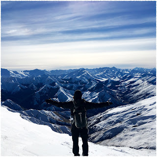
Standing above the clouds, the sweeping views across the Snowy Mountains and Victorian High Country are stolen between the frozen nebulous mass and do not disappoint. We stayed as long as the freezing temperatures would allow to soak in the fresh alpine air and celebrate Blake's achievement, before returning along the track to Thredbo for a well-deserved beer.


Distance: 75.8km

Tuesday, 2 August 2016

Ben Lomond

Two silhouetted figures descend from the saddle. One wearing an ill-fitting overcoat, jeans and trainers. The other was wearing more suitable attire for being knee-deep in snow on a mountain saddle. In a thick French accent, the more competent looking of the two announced: "You should turn back. There is avalanche danger."

The track to Ben Lomond begins among Douglas Fir on the Skyline Access Road which winds its way up through the Queenstown Bike Park. At an altitude of roughly 800m, I leave the shelter of the forest and wind my way up a shallow, snow-covered ridge. Under the thin layer of snow, the alpine tussocks and shrubs give the ridge a bubbly, bobbly appearance. The well-trodden track is full of compressed snow which makes the steady climb tricky underfoot. I reach the crest of the ridge and pop out from under the blanket of clouds that cover Queenstown and Lake Wakatipu. I pause for a moment to catch my frozen breathe and enjoy the truly awe-inspiring view.

The snow continues to get deeper as I ascend further above the clouds towards the sapphire blue sky. A few hundred metres before the 1326m Ben Lomond Saddle, I meet two French speaking gentlemen. Max from France and Gabriel from the French speaking part of Canada. I look up at the steep, rough ridge to the 1748m summit and struggled to see where the avalanche dangers are. After a brief discussion, they stop for lunch and I continue to the bottom of the ridge to take a closer look.

The saddle reveals two surprises. First, stunning views of marshmallowy clouds with only the highest of peaks of the Mt. Aspiring National Park poking above them. Secondly, a group of school kids. Two guides and two teachers had led the twenty bleary-eyed youngsters who stood before me here to experience a winter camp as part of their schooling. Another brief conversation with the guides, my mind is made up and I trot back down to where Max and Gabriel are having their lunch to share my plans...

Max is reluctant, but Gabriel is keen. Given that Gabriel looked more competent, we team up and Max happily descends to Queenstown.

The ridge line alternates between wind packed, crusty snow and more knee-deep, soft snow, which slows our progress towards the summit. As we ascend, the blanket of cloud lifts to reveal a breath-taking palette of colours that create the landscape surrounding Ben Lomond. On one side, the lilacs, whites and earthy tones of Mt. Aspiring National Park. The other is every shade of green sandwiched between white peaks and the deep blue of Lake Wakatipu. At the end of the lake a few flecks of random colours represent the buildings of Queenstown.

Seventy meters below the summit, we need to leave the ridge and traverse a steep, snow-covered face to gain the summit. Gabriel went first. The snow gave way more readily than on the ridge and he sank to above his waist. Gabriel looks back with saucer-like eyes and, without a word, I knew what he was thinking.

Monday, 28 July 2014

Monday, 22 July 2013

Mulhacén

Bleary eyed, I smash my alarm until it ceases making a racket at such an early hour! Even a shower does nothing to rouse me from the state of semi-consciousness in which I find myself. I devour my dry prepackaged breakfast and begin to pack my bike. The air at this hour and this altitude (1500 metres) has a crisp bite to it. I hop on my motorbike and ride to the end of the loose and bumpy road.

Mulhacén rises to 3482 metres and is the highest peak in Europe outside of the Alps and the Caucasus Mountains. I approach from the South and am informed that the ascent is roughly nine hours of walking from Hoya del Portilla (2145 metres). Most people do the ascent over two day. I am not most people though :)

After returning to collect my sunglasses, I begin, for a second time, to hike up the huge southern slope that has the shape of a half pipe rising to the summit. My breathing is heavy and my heart is trying to jump out of its ribcage, as I do not have nine hours to complete the route.

Whilst the south flank of the mountain presents no technical challenge, the mid-morning sunshine is already enough to put sweat on my brow. I take few breaks as I continue to push up the mountain. I reach the summit at shortly before 1pm and peer down the steep North face. This is an impressive piece of rock and I wish I had climbed a route on this instead. Still, now there is something to come back to ;-)

On a clear day one can see as far as Morocco and half of Andalusia. Today is not a clear day though. I descend the steep scree slope of the west flank and retrace my route to Hoya del Portilla. Seven hours and thirty minutes after leaving, I arrive back at my motorbike. I am shattered. This is one ride that I am not looking forward to!

I slide my way down the track and ride zombified to Granada, where the hunt for accommodation begins. The overwhelming heat over Granada compared to the freshness of the mountains is almost unbearable. Next on the agenda is food...

Granada is the first place I have come to in Spain that offer free tapas with every drink. What a fantastic idea! As I am sampling the menu of a local eatery, I discover the most entertaining drunk in Spain. Tears of laughter roll down my face as this Basil Fawlty character chats up the most beautiful women around by revealing his secret: he is Che Guevara. He is so surprised when this revelation fails to have the desired effect, that Che begins to hurl abuse at them in German! ...Maybe you have to be here ;-)

Tuesday, 23 August 2011

Which way do we go!?

After (too) much deliberation over our final route, we eventually settled on a rock route up the Egginerjoch and along the ridge towards the Mittaghorn before descending to Saas Fee.

Unfortunately when we reached the bottom of the route, no-one could pick out a clear route up the steep ridge from the vague description in the guide book. In addition, two members of the group did not feel confident to attempt the rock route in big boots and with our big bags.

So this year's Alpine adventure has kind of fizzled out... Matt and I headed straight to the valley for some sports climbing, whilst Tim and Simon headed up the Mittaghorn via the walker's route.

That said, during this year's Alpine adventure I have climbed my first 4000 metre peak! Happy days :)

Monday, 22 August 2011

Strahlhorn

After the best night's sleep at altitude so far, the 3am wake up call was surprisingly easy to respond to. I forced heavy bread smeared with some sort of plastic cheese into my belly and headed off into the dark...

From the Britannia Hut a marked track led steeply down to the rubble strewn Hohlaub Glacier. We then traversed the glacier and popped over a rock shoulder to join the Allalin Glacier. Ascending the glacier on the right hand side took us under the cliffs of the Hohlaubgrat and the Rimpfischhorn. We then weaved a route through the crevasse fields to reach the Alderpass (3789m).

From the col, we climbed the rounded snow ridge before continuing in the searing heat of the sun on more open slopes. One final steep section, one final push - we reached the horizontal summit rock ridge (4190m) and peered over... The view down the other side made my knees go wobbly. The face was almost vertical and over 600m high.

We were fortunate to have this small exposed rock ridge to ourselves, so we took the obligatory photos before descending...

For me the descent is always the trickiest bit. You are tired. The heat from the sun is melting the snowbridges across the crevasses. Your knees hurt. Rocks are falling from the cliffs... I could go on :)

That said, the plod back to the hut went without any major incidents.

After 11hrs and 20mins on the route, we arrived back at the Britannia Hut for a well deserved rest.

Sunday, 21 August 2011

The Purist Approach

With clean clothes, a new rope and feeling more acclimatised, we began the climb out of Saas Fee to our base for the next few days - the Britannia Hut.

The purists amongst you will appreciate the fact that we did not use either cable car to access the hut. Instead we climbed through the forest to Plattjen (2570m) and snaked around the East sides of Mittaghorn and Egginer to the final ascent over moraine and Chessjen Glacier to 3030m.

The Britannia Hut holds three times as many people as the Bordier Hut and is one of the busiest huts in Switzerland, despite being on the edge of the wilderness of the Allalin and Hohlaub Glaciers. The views towards the Strahlhorn and Rimpfischhorn are wonderful. From the hut, we could pick out West-North-West Flank on the Strahlhorn - our route for tomorrow...

Saturday, 20 August 2011

Die Bergengel

With a knackered rope and a lack of proper acclimatisation, we decided to go down to the valley and have a rest day. Retracing our route down was supposed to be straightforward and it was until we met Rudi and Elisabeth...

This elderly Swiss couple were slipping and sliding their way across the Ried Glacier. Naturally we offered assistance, for which they were most grateful. As we safely reached the footpath, Elisabeth told us a story of how you must be courageous in the mountains and the Bergengel (Mountain Angel) will protect you. She said that we were her Bergengel, which was nice. I think we all had an extra spring in our step on the way down because of that :)

The rest of the trip down and round to Saas Fee was pleasant, but fairly uneventful.

Once we had cleaned up and completed our food shop, we headed to a local crag for a spot of sports climbing. The crag (Biele) is situated just below the top part of Kapellenweg - the path linking Saas Grund and Saas Fee. As the sun began to set, the North face of the Mittaghorn was lit up and provided a wonderful backdrop to our climbing position.

That evening we headed off into the town to find somewhere to eat and celebrate Matt's Birthday. Happy Birthday Bud!

Friday, 19 August 2011

Balfrin

The 7am alarm was difficult to rise for despite being in bed by 10pm! My first night at altitude never results in a good night's sleep - I tend to have the strangest dreams and last night was no exception :)

The Balfrin and Gross Bigerhorn were chosen as our training and acclimitisation route. After a simple yet effective breakfast, off we set... only to discover, once we were out of sight of the hut, that I had left my sunhat, sunglasses and camera behind :(

With the sound of the Mountain Guide's heckling still ringing round my head, I rejoined the group and we set off in earnest.

The track from the hut twisted and turned ever upwards along the moraine until we reached the glacier.

Care was taken on the glacier as yesterday two people fell into crevasses. However, we successfully navigated our way through the crevasses to the plateau of the glacier.

From here we climbed to the crest of the South West Ridge via a scree slope. The rock on the scree slope was loose and not much better on the ridge - this lead to a few nervy moments...

Towards the top, the ridge narrows but we were able to climb in on the South side. I was beginning to feel the effects of altitude. My heart was thumping so hard I thought my ribs we going to crack. Maybe we needed to take longer to acclimatise...

Just as we reached the South summit, snow and hail began to fall, so we abandoned our plan of traversing the summit ridge to the slightly higher North summit (well it is only 12m higher!). Instead we traversed the main NW ridge towards the Gross Bigerhorn. As we rammed a quick sandwich down our gullets, I noticed a nick in the rope which may prove problematic...

Descending the steep snow slope off the summit was made tricky because of the knee deep, soft snow on the ground and the hard snow falling from the sky.

From the saddle at 3594m (Balfrinjoch), a rocky ridge led to the summit of Gross Bigerhorn. Despite the guidebook describing the ridge as an easy snowy ridge, we saw no evidence of either! There were some tricky gendarmes to climb around or over en-route to the summit.

We stopped on the summit of the Gross Bigerhorn long enough to take a few photos and a quick check of the rope... The cut was getting deeper. We then descended the West-South-West Ridge which was essentially the biggest collection of jumbled boulders I have ever seen.

Back at the Bordier Hut again - just in time for tea after nine and a half hours on the route - another rope check: I can now see the core of the rope. Not good. Maybe we need to rethink our plans!

Thursday, 18 August 2011

Ah! Bisto

After a leisurely start, we departed the Matterhorn Valley Hostel in Gasenreid and headed up to the Bordier Hut (2886m). On the bridge that crossed the glacial river, our noses caught the scent of freshly BBQd meat.

It was as if we were in a Bisto advert; we floated across to the picturesque lake (despite our weighty rucksacks!). Unfortunately the distraction resulted in us being on the wrong path... (to be fair, we have subsequently discovered that there were only three signs pointing us in the right direction!) Despite this, we only realised that we were on the wrong path at the head of the valley. At this point, the sides of the valley towered over us, so we had a dilemma - retrace our steps or scramble 150m up loose moraine. We chose to scramble. We chose badly...

That said, this did lead to a beautiful secluded Alpine meadow - ideal for a wild camp. We rejoined the path and headed onwards and upwards, but I was feeling the effects of the altitude.

The top of the zig zag path joined the Europaweg which lead to the base of the Ried Glacier which we needed to cross to reach the hut. Halfway across we refreshed our crevasse rescue technique - just in case...

We reached the Bordier Hut just in time for tea :) This small quaint hut is in a remote and wild setting under the upper glacier downfall.

As we were tidying up after our hearty meal, we were joined by some Steinbock who were enjoying licking the salt off the rocks.

With the sun setting and a storm rolling in, we planned our route for the next day and jumped in to our cots for the night. Zzzz

Wednesday, 4 August 2010

Mont Blanc de Cheilon

The hustle and bustle of the hut is tricky to cope with at the best of times; 5:15am is not the best of times! Bleary eyed, I got fed and watered. I was relieved to get out on to the route...

After a slippery start on the bridge, we headed along the moraine past the beautiful pyramidal form of the Mont Blanc de Cheilon to the Col de Cheilon (3 243m). Here, we prepared ourselves for glacial travel. We climb on to the glacier and slogged our way up it, dodging the huge crevasses that lay in our way.

The steep ascent up the glacier took us to a South West Ridge, where we could take in magnificent views of the Matterhorn, La Ruinette, Dent Blanche and Mont Blanc. The final steep section of rock on the ridge took us to the small summit at 3 870m, which was barely big enough to fit us all on!

We then followed our earlier footprints back down to the col and past the clear-cut north face, which we had sat upon hours earlier, to the Cabane des Dix. After a short pitstop, we continued onwards and downwards to Arolla...

Tuesday, 3 August 2010

La Luette

As I peered out of the hut window, I could not quite believe what I was seeing... Snow in August!?!

With our stomachs full, we trudged off in to the mist leaving the warmth of the hut behind. The path from the hut snaked it's way along the moraine to the Glacier de la Luette.

We put crampons on, roped up and took our ice axes in hand and began to weave our way between crevasses. The steep zig-zagging route took us to the col at 3465m.

After a short food break, we climbed a loose rocky ridge to the summit of La Luette at 3548m. From this fantastic vantage point, the clouds parted to grant us a quick peek at what surrounds us.

We then re-traced our route back to the Cabane des Dix that has a deserved reputation for great food :)

Saturday, 18 August 2007

Peak of the Snowy Rope Maker

4:30am alarm call - I sat up to see a trail of headtorches snaking their way up the snowfield in front of the Barre des Écrins.

By 5:30am we were on our way. We made the steep climb up to the Brèche Cordier. This was accidental - we had gone to the wrong col, due to the lack of snow!

After some debate over the best route, we climbed the ESE ridge of the Pic de Neige Cordier and summited at 8:30am. We sat on the summit taking in the views and lots of photos :) We then descended the ridge, the glacier and then the tourist path to arrive back at our car by 2:30pm.

Friday, 17 August 2007

A Room with a View

After an early morning food shop, we packed our rucksacks and made the picturesque drive to Pré de Madame Carle.

From here we hiked up to the Glacier Blanc and bivvied about 1km before the Refuge des Écrins (at approx 3000m).

The view of the Barre des Écrins was stunning. The night sky was so clear - I've never seen so many stars! After we ate our gnocchi, we climbed in to our bivvy bags and tried to get some sleep before tomorrow's adventure...

Wednesday, 15 August 2007

Col du Clot des Cavales

4:30am - out of the house by 5am - start walking by 6am. At this time of the morning everything seems a little blurred.

At first we hiked along the valley bottom, which looked like something out of the Lord of the Rings.

We then took the steep right hand fork up to the Glacier du Clot des Cavales. Crossing the small glacier took us to our final destination - Col du Clot des Cavales (3158m).

The views through the col were stunning. The ground just fell away from us down to the valley bottom.

We fueled up on mackerel sandwiches and then headed back to Le Pied du Col to find the car.

Later that evening Tom and I completed the "Italian Job" :)