Showing posts with label The Long Way Home. Show all posts

Sunday, 12 August 2012

What if?

Now that I am leaving home, what I do I make of the journey that brought me here…

First, whenever I told people about my plans, the responses tended to be:
What if this happens? 
What if that happens? 
What if you run out of petrol? 
What if? 
These two little words could easily have stopped me from jumping on my motorbike. In fact, it was these two words that made the trip for me. The “what ifs” and the “maybes” made life on the road so exciting. Every time I got into a spot of bother, I met people that helped (which gives me a much rosier view of the World) or I figured something out myself (as I like to think there are no problems; only challenges).

Secondly, I never got tired of riding my motorbike every day. I love being in my own little World inside my helmet. It is like a meditation which begins from the moment I put my earplugs in.

Finally, some of my favourite parts of the journey may not seem that special. We seem to be conditioned to think that our lives revolve around great moments, but these moments often catch us unaware. They can be beautifully wrapped in what others may consider a small one, such as a chance meeting or a random conversation. For me, the trick is to recognise them...

Distance: 3515.5 miles (Scandinavia)
Distance: 588.6 miles (UK)
Distance: 4104.1 miles (Total)

Tuesday, 24 July 2012

All roads lead to Göteborg

After a lovely breakfast, we all head down to the harbour and hop aboard the family boat. As we cruise along the fjord, the boys and I sit on the front of the boat riding the big waves. We dock at a little rocky outcrop for a spot of crab fishing and enjoy a BBQ. What a life! :D

Alas, I have to leave as my ferry departs this evening and I still have one more country to visit! I say goodbye to the gang and leave them to fill the crab bucket :)

One lane becomes two and then three as I hurry towards the Swedish border. The bridge from Norway to Sweden offers a stunning view out to sea. Just one hundred miles to go!

I follow the Göta älv into Göteborg and reach the area where the harbour is. I can see the ship. I can even see the sea! Can I find the entrance? Not easily. I turn left. I turn right. I carry on straight ahead. The result is the same; I head to the centre of Göteborg. I end up going through the Lunby Tunnel four times before I eventually discover the tiny turning for the freight harbour.

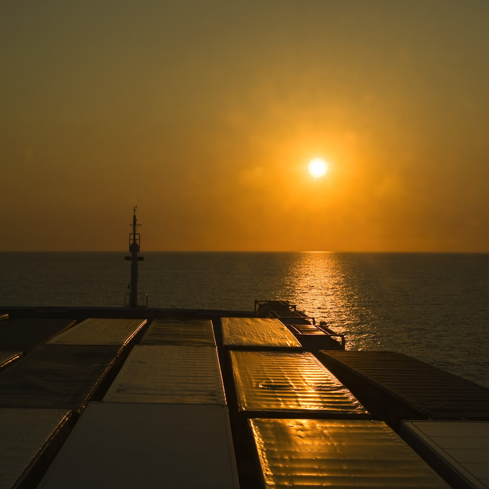
It is here, whilst waiting to board the ship, that I will finish the story of my latest odyssey. It is not that the adventure is over. No way – I am very much looking forward to the summertime escapades with my friends and family. Next time my wheels roll will be on the green and pleasant land of my home. I have ridden my motorbike all the way… The Long Way Home.

Distance: 179.3 miles

Monday, 23 July 2012

A Good Deed

After the best breakfast of the trip so far, I start the day with a good deed. A Swiss biker is heading North and is short of few pieces of equipment. Since I am heading South to supposedly warmer and drier climes, I hand mine over. I now hope the weather Gods will smile on me…

Shortly after leaving Trondheim en-route to Moss, I cross the three thousand mile barrier for the entire journey as suburbia gives way to farming and then forests. Southwards the scenery is mixed but the winding ascent to Støren through the Sokmedal valley is as good as any on the whole trip.

Crossing Dovrefejellet I am reminded of Saltfejellet wearing its Sunday best. Norway’s oldest national park is a wild but not bleak mountain plateau of wonderful beauty. The views are picture postcard perfect. It is all a bit twee really.

Dombås is the definition of a tourist centre. This orgy of caravans, campervans and motor homes is a bustling and lively stopping place for travellers. It is so liberating to be on my motorbike as I easily weave around ill thought out parking manoeuvres or general incompetence.

I am exhausted as I arrive in Ringebu, the midpoint for today’s route. I pull off the main highway down a small track and take a quick nap on the banks of the Lågen in the scenic Gudbrandsdal.

As I approach Oslo I begin to tire and seem to enter a trance like state as the unvarying scenery of farmland and forest does little to capture my imagination. In the Southern commuter belt of Oslo, in the town of Moss, lives my old friend Brookie and his family. I have only seen Brookie once since he moved to Norway. It is lovely to see a friendly face at the end of long day and enjoy some home comforts.

Distance: 373.1 miles

Sunday, 22 July 2012

Highway to Hell

Today I leave the Arctic Highway behind. South of Mo i Rana essentially the same road has the catchy title of “European Route 6”.

As I ride through the suburban sprawl the heavens open. I cannot complain though as I ride through more lush scenery – in any weather this is a stunning place to be.

The next two days are all about eating up the miles as I have a ferry to catch!

The first pit stop is at Laksforsen, another impressive waterfall where if you are lucky salmon will be leaping. This natural beauty spot is spoilt (in my humble opinion) by the construction of a café. To add insult to injury they have also erected huge fences to prevent people from viewing the falls, unless of course you can climb – which naturally I can  :)  As I sit on top of their fence admiring the falls, I wonder what gives someone the right to prevent others from sampling one of Mother Nature’s gems…

Just South of Majavatn is a fairly impressive sign to signify the start (or in my case the end) of Northern Norway. As I set up my motorbike in the right place for the obligatory tourity photo, I drop it for the first time on the whole journey. Weary from all the riding, I struggle to lift the 350kg monster. Fortunately there is no shortage of volunteers to help lift my motorbike back into place.

My next stop has little to offer other than a cheap chuckle. For next time someone suggests that I can go to Hell, I can honestly say that I have been there and back and it was not that bad ;-)

It is a strange having ridden so far South to reach the most northerly place in Norway that merits the classification of ‘city’. Trondheim, Norway’s original capital, has a great feel to it. I instantly feel at home here. Perhaps it is the compact centre. Perhaps it is the cosmopolitan feel. Perhaps it is the student vibe. Whatever it is, Trondheim has an unrivalled charm. I wish I had longer to stay…

Distance: 306.5 miles

Saturday, 21 July 2012

A day at the races

Despite the potential for supernatural events, an uneventful night results in a very good night's sleep. It is a chilly and bleak morning on the high moorland of Saltfjellet. Surrounded by snow, I set off southwards in search of warmer climes…

Approaching the summit of the plateau, the Arctic Highway is snugly sandwiched between the railway and some splendid rapids. The watershed between north- and south-flowing streams indicates the highest point of the vidde, at just over 692m.

Shortly after this I reach the Arctic Circle, which is marked by a line of cairns and the recently built Polarsirkel Senteret. It is quite a contrast with my first crossing of this significant waypoint. Still, I stop to sample the mass produced touristy tat and cannot help but feel that something of the magic of crossing the Arctic Circle has been lost.

Leaving the railway line and the tourist trap behind, I feel my spirits rising as I descend into a lush, green environment. The Arctic Highway now criss-crosses the course of the River Rana through Norway’s second most northerly spruce forest.

Further down the Highway is one of those surprises that could easily be missed. A large white sign indicates that the small road to right will lead to the Arctic Circle Raceway! I feel compelled to investigate…

I follow the narrow poorly maintained road for a few kilometres. The only thing stopping me from giving this up as a weak practical joke is the occasional set of wiggly tyre tracks; as if people were warming up their tyres for something…

As I turn onto the track of a disused railway, I feel like I have been had. What was I thinking!? A racetrack a snowball’s throw from the Arctic Circle…and then it appears. This 3750m racetrack is reported to meet the standards of Formula One racing. I head over to a man wearing a Manchester United cap and before I know it, he agrees for me to race a few laps!

It is at this point that I should mention that I love riding my motorbike, but I do not consider myself a biker. Nor am I a speed demon, as my friends Ralf and Dick will confirm. I pootle along taking in all the sensory stimuli that you miss when you are encased in a car. I do not think there is any feeling in the World like that of covering hundreds of miles on the back of a motorbike.

All that said, once I get on the racetrack I hear Murray Walker’s commentary in my head and I fly! I try to stick to the racing line marked out by the rubber on the track. This involves taking corners at 90mph and almost touching the floor with my knee. By the end of my second lap, I have a huge grin on my face, so I turn off into the pit lane, wave goodbye to the kind folks and head back to the Arctic Highway.

With only eight miles left until my final destination of the day, I stop for some lunch in Røssvoll and go over the details of my next excursion…

Route 353 leaves the Arctic Highway and passes the local airport situated on the South end of Langvatnet. Shortly after, there is a fork in the road and I opt for Route 354 which follows the Røvass, a river carrying the meltwater away from Svartisen, Norway’s second largest ice mass. My destination is Lake Svartis in the hope of seeing the snout of the glacier, but the glacier is shrouded in mist.

I head back to the junction with Route 353 and this time take Route 355 across the turquoise coloured Røvass to Melfjordbotn. The destination is not important; the journey is the part that interests me. Until 1982, the only way to Melfjordbotn was by boat. Now a beautifully engineered road climbs up on the Melfjellet. The scenery is quite spectacular: ice-scoured rock, small lakes waterfalls and magnificent peaks – this is a thrilling place to be.

Suddenly, and almost without any warning, Melfjordbotn can be seen through the thin clouds hundreds meters below at the head of the fjord. The road then steeply snakes its way off the plateau. I pray I do not meet another vehicle. The road is, at some points, barely as wide as a car and the hairpin bends are so sharp that I wobble my way around them in first gear.

Once I am below the clouds I am soaked to the bone by a heavy downpour, so after a few photos of Melfjordbotn I hop back on my bike and head to Mo i Rana.

The Arctic Highway follows the river and railway line through a magnificent gorge to Mo i Rana. Mo is home to Anthony Gormley’s Havmannen (Man of the Sea) and will be my home for this evening.

Distance: 151.7 miles

Friday, 20 July 2012

“Some places are like people: some shine and some don't.”

I am in the car park packing my motorbike and contemplating what the day may have in store for me, when I notice out of the corner of my eye an old man approaching. He begins to talk in a language that I do not understand; despite this we were able to communicate and share a smile. It is things like this that I love.

With four quick flicks of my left foot, I am cruising southwards along the Arctic Highway. I make a quick stop at Husmannsplasen. In 1967 these cottages fell vacant on the death of the last farmer to work there. Time has stood still here with the exhibits being left just as they were.

Tunnels disrupt the marvellous vista on the journey to Fauske with irksome regularity. I race through a tunnel and as soon as daylight hits my visor, the throttle is loosened to take as much of the view in as possible.

Another quick photo opportunity at Fauske, the centre point of the E6, the road I joined at the Finnish-Norwegian border and will leave to the Norwegian-Swedish border. All these stops must be brief though, as I have an appointment with Mother Nature…

At 12:54pm the tide will be coming into the straight that links the open Saltfjord with the inner Skjerstadfjord. This gives me the best opportunity to see one of the world’s strongest maelstroms. Having read about the four hundred million cubic meters of water smashing ships to pieces, I am expecting big things. I stand on the summit of the Saltstraumbrua for forty five minutes watching the small cauldrons threaten to join forces and form one massive whirlpool. Instead my reward for all the effort is nothing more spectacular than the water swirling around my bath plug. I am gutted and freezing!

I do not warm up for the rest of the day; the Arctic wind cuts through my insulated jacket as if it is made of toilet paper. Despite this I still enjoy the mountainous and winding ride along Route 812, which traces the edge of the Saltfjord. I join the Old Arctic Highway shortly before Medby and take a more serene ride through a more rural setting.

Eventually I am forced back onto the new Arctic Highway where I ascend on an undulating course in the slender gap between the snow line and the low-lying clouds. The tree cover is thick and obscures the view of all but the high peaks. Occasional breaks in the trees reveal the powerful Salteva where, upon closer inspection, I see men up to their waists in the strong currents fishing. Now they must be cold!

Shortly after Saltdalen Tourist Centre I take a short excursion towards Sweden to peer into the spectacular Junkersdalsura canyon and sample the old route into the valley. The first stretch of Route 77 is very steep and twists along the edge of canyon. The journey up is fine though as my focus is always on the bit of tarmac in front of me. From a small layby I satisfy my curiosities about the canyon and begin the journey back to the Arctic Highway. Despite the route from 1871 being replaced by the modern Route 77, the route is terrifying. The exposure to the sheer drops on my right make me want to close my eyes... Although this is probably not advisable ;-)

Further down the tree-lined Arctic Highway, a small turning right leads to the centre of the middle of nowhere, Lønsdal. There is quite literally NOTHING going on here. Nothing to see. Nothing to do.

What is more my accommodation for the night has a striking resemblance to the hotel from The Shining. It also looks closed. I walk up to the door and pull, then push. It is closed.

Moments later a car screeches into the car park. The Addams Family get out of the car. Despite still being chilled to the bone, I begin to sweat. A mumbled apology in a thick Russian accent is all I can decipher as my arm is almost yanked from its socket with an overzealous greeting.  We enter the building.  The interior does not feel any less unnerving and then, to top it all off, I am handed the key to Room 237.

Due to a misspent first year at University, I am well aware that Room 237 is where all the freaky stuff happens in the film. I slowly climb the stairs to the second floor. My heart is thumping as I put the key in the door and turn…

Sleep well folks!

Distance: 139.9 miles

Thursday, 19 July 2012

EWS

Never failing to disappoint, the breakfast at Norumgården is fit for a King (who incidentally stayed here once). My belly is full, my bike is packed and I am ready to start the day… Or am I?

I type my first destination into Tom-Squared. Destination unknown is the reply. I try the second. No luck. I try all my planned stops and nothing is recognised. Plan B: I look on my map and the scale is too large to be of any use. Plan C: I will use the vague descriptions I have and my common sense. Let’s see how far this gets me…

The first part of the route is simple. Follow the Arctic Highway southwards until the ferry crossing at Skarberget, but this description does not do the journey justice. After I escape the suburban sprawl of Narvik and the neighbouring villages, I pass through some of the best scenery of the journey so far. I am fast running out of superlatives to describe the view from my helmet. The mountain route passes towering peaks and weaves between glistening fjords.  I stop to take a few photos of a particularly beautiful stretch. I return to my motorbike, turn the key and nothing happens. The usual green light is replaced with three letters - EWS.

I have no idea what the letters mean. More importantly I do not want to be stuck in this uninhabited wilderness! I frantically fiddle with anything that moves. I press. I twist. I tweak. Nothing. Nothing. Nothing.

I give the key one last turn before I dig through my luggage in search of the manual and the green light appears. I hit the ignition button before the computers realises it has made a mistake. The engine roars into life and I race to the ferry, all the time trying to figure out what the letters EWS stand for…

I roll into the dock just in time to see the ferry close its thunderbird-two-style doors and float away. The next ferry is in an hour. Luckily there is a café, so I take my owners' manual and hope to find the solution to the EWS problem. 

I still do not know what EWS stands for. My guess would be a German abbreviation, but I do not know. I do, however, know what caused the malfunction. I am embarrassed by the cause.

EWS means the motorbike does not recognise the key in the ignition. It is a security feature that immobilises the motorbike. So why is this happening?

Well, my keys are dirty. They are covered with the grub and grime of thirteen days on the road. I am so relieved that I do not mind being scolded like a naughty child by my German motorbike for having dirty keys. A quick wipe with napkin and my motorbike is repaired :D

After crossing the narrows of Tysfjorden, I follow the Arctic Highway for a short while until I reach Ulsvåg. From here I take a little side trip to the Nordneset Peninsula at Tranøy. The views across the Vestfjord and to the lofoten Islands justify the detour.

Back with the Highway, I continue to ride southwards along the edge of Sagfjord. Across the fjord are more stunning views of islands poking out of a fjord.

The highway leaves the fjord and heads once more into the mountains. Dominating the cloud-covered skyline is Kråkmotind, a mountain peak that seems to have had its peak sliced off! Like most of the summits here, it rises just to or above the permanent snow line.

Road tunnels punctuate the final section of today’s route. Each tunnel takes me into what I imagine to be the crater of a huge volcanoe. A ring of mountain peaks, each wearing their snow caps at a jaunty angle, surrounding a tree lined, crystal clear lake.

My accommodation, Kobbelv Verthus, is a short distance after the third tunnel and occupies one of the most attractive settings along the Arctic Highway. It over looks the Leirfjord and is alongside Baggfossen. Time to sit back, relax and enjoy my mooseburger…

Distance: 158.3 miles

Wednesday, 18 July 2012

The road less travelled

My alarm sounds. I roll over. I have a hangover. Probably the northernmost hangover I have ever had. My stomach is churning – not too bad though, the slow cycle. As the scales fall from my eyes, I look around the room, slowly focus and groan in despair. I have done it again…

My drunken logic dictates that if I pay nearly ten euros a beer, then the glass must come for free. So in my hotel room are eight pint glasses in a variety of sizes and brands. One even has a kebab in it! What a muppet :)

I lie in bed and try to cure my hangover by groaning and breathing heavily. Unsurprisingly this approach has limited results – I might as well try aromatherapy! I stagger down to breakfast with two minutes to spare in the hope that something solid will help. It is midday before I feel ready to sit on my motorbike.

I can see the rain clouds rolling up the fjord towards Tromsø as I pack my motorbike. The clouds deposit their cargo just as I leave the ‘Capital of the North’. I travel the route back to Fagernes through the mist in the pouring rain. I see nothing. Absolutely nothing.

By the time I reach Laksvatn the weather is better, so I choose to leave the heavily used highway for the cosier Route 292, which runs underneath the main route along the edge of the beautiful Balsfjord.

In Nordkjosbotn I refuel my motorbike and myself, before doubling back a little to avoid the industrial Arctic Highway. Route 87 starts in Øvergård and is another attractive alternative to the Arctic Highway, passing through the captivatingly beautiful Tamokdalen.

Towards the end of the route I investigate a minor road to the right, which leads to Målselvfossen. The mighty Målselvfossen, 600 meters long and (only) 25 meters high, proudly declares it was Norway’s national waterfall in 2003! The plunge pool at the base is one of the best salmon fishing spots in this part of Norway, but it’s not all doom and gloom for the fish. Those salmon that escape the fisherman’s hook are helped up the fall by Europe’s longest salmon ladder.

Rejoining the Arctic Highway a short while later takes me across the beautiful Sagelvvatnet. There is a scattering of lakes and memorials (to the 1940 Battle of Narvik) along the route that is taking me to Narvik.

The windy exposure on the 800 meter long Rombaksbru is unsettling, especially when the traffic lights order you to stop at the high point of 40 meters above the fast running Rombakstraumen.

Shortly before arriving in Narvik, I stumble upon the police clearing up the aftermath of a car accident. A timely reminder of how tricky this road can be.

Having been to Narvik before on a snowboarding expedition, I choose to once again stay in Norumgården Bed & Breakfast. For me this speaks volumes about the quality of this little treasure that was once used as the German officer’s mess in WWII and nowadays exudes character. I am off now to take a trip down memory lane…

Distance: 175.2 miles

Tuesday, 17 July 2012

A ferry lovely day!

My morning routine is becoming quite slick now and once I tie up the loose ends from yesterday, I hit the road…

As the Arctic Highway threads its way towards the top of the plateau-like col, what little shelter was afforded by the Trolldalstind range is lost. As I begin to descend the open waters of Øksfjorden come into view. Down on the valley floor, the highway runs along the fjord edge only a few meters above the water.

From Djupvik the Arctic Highway now turns southwards, in contrast to the previous westwards course, and this is now the direction I will be travelling in for the rest of the journey.

Olderdalen is the ferry point to Lyngseidet and where I leave the Arctic Highway for a few days. As I wait for the ferry to arrive, I admire the Lyngen Alps across the fjord. This small, but perfectly formed, mountain range rising majestically from the deep waters is a truly wonderful sight.

The ferry arrives and opens its massive mechanical mouth, in a scene reminiscent of the Jaws movies, to spit out the vehicles it had swallowed in Lyngseidet. Feeding time for the ferry begins once more as one by one vehicles are willingly swallowed. The whole process is very efficient and before I know it, we are sailing…

The crossing of the Lyngenfjord takes forty minutes and then my wheels roll onto Route 91. This splendid, if short, ride amongst the imposing peaks of the Lyngen Alps clocks up the two thousandth mile of the journey.

Svensby arrives too soon and the slick boarding procedure is repeated. The twenty-minute crossing is as rewarding as the first. The ferry docks at Breivikeidet where Route 91 continues.

Rising away from the Ullsfjord through a narrow birch-filled corridor, I feel like I am travelling through a JRR Tolkien novel. Small hanging valleys score the steep sides of the main gorge; it is a most beautiful setting.

At Fagernes, I join the functional route into Tromsø. I stop on the outskirts of Tromsø to check out the Arctic Cathedral. Strictly speaking it is not a cathedral, but this does not make it any less impressive. It is made from eleven triangular sections which represent the twelve apostles minus Judas.

I ride across the impressive Tromsøbrua and make a quick pit stop at my hotel as I have a deadline to meet...

Tromsø is home to perhaps the World’s only, never mind most northerly, pub to be closed by 6pm!! Despite the shortage of time, I sample most of the very quaffable beers that the Mack’s Brewery Ølhallen Pub has on offer.

In need of some fresh air, I wander around the harbour and stumble across a statue to Roald Amundsen.  Now my belly starts to rumble, so the nooks and crannies of Aunegården are where I acquire some sustenance. This delightful café-cum-restaurant used to be a Butcher’s Shop and, as a result, is rich in character. I have an excellent salad and mouth-watering chocolate cake.

Time for some more beer at Verdensteatret. Within moments of entering Norway’s oldest film house, which is now a funky bar, I manage to upset the owner by accidentally stealing his chair. After a friendly discussion, diplomacy prevails and I secure a tour guide for my evening. The tour starts by sneaking a peek at the glorious cinema, which is in the rear of the bar and ends in the cool basement hangout called Bastard.

Distance: 96.8 miles

Monday, 16 July 2012

Soup fit for a King!

Riding a motorbike without all the gear on is both liberating and slightly unnerving. Sautso Gorge is my first destination of the day and, in the name of efficiency, I ride my motorbike in my walking gear along a narrow graveled track to a small marked plot where vehicles are to be left.

I feel quite cool in front of the small crowd of hikers as I ride into the parking area, hop off my motorbike and, without any faffing, head off to the canyon. The impact of this is somewhat lessened when moments later I return to my motorbike to fetch the keys out of the ignition! What a muppet :)

Sautso Gorge is Northern Europe’s deepest canyon. The Altaelva cuts the canyon into the Bæskades mountain plateau. At a maximum of four hundred metres deep and six kilometers long, it is well worth the hike.

Ascending up from the edge of the canyon, I meet a couple and we begin to chat… Like me they are heading to a wedding in the UK. Like me they have decided to drive. Like me they have decided to take a scenic route. Unlike me they started in Australia!! We stand and chat for almost an hour, swapping funny stories of our travels. Check out their story here. 

Our only pause comes when we hear a large boom! Moments later two fighter jets sweep around the tight bend in the canyon and blast along underneath us. They must only be a maximum three hundred metres away from us. As they reach the end of the canyon, the two jets climb steeply out of the canyon. As if this task is not difficult enough at such speeds, they begin to barrel roll and crisscross their paths as they climb. Our own private air display from the Norwegian Air Force!

Somewhat shell shocked from the remarkable sight that we have just witnessed, we say our farewells and head off in opposite directions. I make my way back to the Gargia Fjellstue to clean up and fill my belly. Whilst devouring some of the tastiest salmon soup I have ever eaten, I tell the owners the story of the fighter jets. They in turn inform me of a possible reason for such an event. The King of Norway is in Alta and, at 6pm, will be salmon fishing on the Altaelva. I have never met a King before… Should I? ;-)

Time is pressing on and so must I. I retrace my route back to the Arctic Highway and continue my journey southwards to the mountains…

At Inestoften, the excellent views are worth a quick stop. The road along Langfjord rises and falls with the topography of the land. Across the waters, the opposite coastline looks sinister as the dark cliffs plunge into the deep waters of the fjord. I leave the Arctic Highway once more for a brief excursion to Saltnes.

I park up by a small yellow farmhouse and walk along the fjord edge. All the way along the track I can see my goal, Øksfjordjøkelbreen. This glacier is the only one in Norway to dip down to sea-level and calve into the fjord.

Back to the Arctic Highway and a fuel stop at Sørstraumen.  As I leave the petrol station, I notice a wall of mountains in front of me. In my exhausted mind I wonder if I have to go over them. Three miles later I get my answer: I do. I wind my way up the mountainside and just below the summit of Kvænangsfjell is Gildetun Mountain Motell, where I will be laying my head this evening.

I am so tired that I do not take my camera out of its case to record the stunning views out across Kvænangsfjord. A job for tomorrow…

Distance: 115.7 miles (Motorbike) and 14.4 miles (Hike)

Sunday, 15 July 2012

Go West!

Porsangerfjorden is North Norway’s greatest fjord and, by area, the largest in Norway. My day starts by retracing the route along the Porsangerfjorden to Olderfjord. I am amazed by how much seems new by just having a different perspective on it. I am sure there is a philosophical parallel to life that could be drawn here, but this connection is for smarter men than me to make.

At Olderfjord, I head west and begin the steep winding ascent through a tree-filled valley on to a bare and uninhabited plateau. The strong crosswind on the upland makes it difficult to simply ride in a straight line!

I descend to Skaidi where Route 94 branches off the Arctic Highway to follow the Repparfjordelv through its wooded valley. The river meets the fjord, which Route 94 continues along the edge of until Kvalsund. Kvalsund Bridge is an impressive sight and one of Norway’s longest suspension bridges; crossing it takes me to Kvaløya (Whale Island), the home of Hammerfest.

Route 94 continues to wiggle its way along the western side of the island. For the most part, the road has a concrete guardrail but many other parts do not! The views are amazing but, again, it is one of those times where I really have to focus on the road, so that I do not fall off it ;-)

Hammerfest makes the dubious claim of being the Northern most town in the World although Honningsvåg (my starting point for today) fails to claim this title only by virtue of its late official classification as a town – so I am told.

I arrive in town and notice there are two visiting liners, so I drive to the top of Salen, Hammerfest’s own mountain to gain a bird’s-eye view of proceedings. As I jump off my motorbike, I hear the boom of a ship’s foghorn – one of the liners is departing. I perch on the summit of Salen to watch the breathtaking spectacle of this huge mechanical monster elegantly manoeuver its way out of the harbour. As the liner reaches the mouth of the harbour it emits another blast of its foghorn, which this times bounces around the fjord like squash ball around a court.

With the performance over, I grab a spot of lunch and retrace my route to Skaidi. I again marvel at what the new viewpoints bring to the same scenery.

Shortly after leaving Skaidi I have a Mexican standoff with one of the most stubborn reindeer I have encountered. Oh sure he lets out a little bit of wee when I eventually sounded my horn, but I am not too sure if this is out of fear or defiance. He pigheadedly does not move until the bus heading in the opposite direction sounds its horn too.

The valley narrows into a gorge as I follow the Repparfjordelv upstream to the Senna vidde. I am buffeted by the wind as I cross the plateau. There are no trees, no habitation, simply bare rock, patchy grass and bog as I head towards the dark grey clouds on the horizon. I reach the edge of the plateau and experience first hand relief-rainfall in action. Thankfully the downpour lasts for a few miles on the steep descent to Alta.

The town’s single biggest attraction is the UNESCO World Heritage Site. The rock art of Alta is the largest known collection of rock carvings in Northern Europe and are between 2000 and 6000 years old. There are a huge variety of figures and scenes. Some are relatively naturalistic; others are more geometric. Stone Age graffiti rocks! :D

To end the day, I leave the Arctic Highway and follow Route 93 along the same path as the Altaelva (one of the best salmon rivers in the world!). I will be laying my head at the famous Gargia Fjellstue. The lodge has been here for almost 150 years and is delightfully situated amongst the trees.

After dining on a sumptuous bowl of Bidos (reindeer stew) I race to my cabin in an effort to outmanoeuver the mosquitoes.

Distance: 222.6 miles

Saturday, 14 July 2012

Knivskjelodden

I have a small confession to make…

Nordkapp claims to be the northernmost point in Europe and is the main destination for most visitors to the far north. It is, however, not Europe's northernmost point, by any definition.

Knivskjelodden (latitude N71°11´08˝) is notable for being the northernmost point of mainland Norway, and therefore of mainland Europe.

Well, I am not coming all this way and not reaching the most northern point! So there is only one thing for me to do…

The continent’s real northernmost point is, thankfully, inaccessible to vehicles. So I ride my motorbike to the marked car park about five miles south of Nordkapp, throw on my backpack and follow the Cairns.

The hike starts off fairly pleasant across undulating terrain until I descend steeply to a sheltered cove. En-route I saw a herd of reindeer – one of which was a pure white!

From this secluded spot, I could see Nordkapp across the bay, shrouded in cloud. Any folk there cannot see their hand in front of their face, let alone the spectacular display of the midnight sun that I was privileged to witness yesterday.

I departed the cove and scampered over slopes of bare rock to the northernmost point of the European mainland and the millennium cairn. Here I signed the visitor’s book (number 604) and took in the view.

I can see why Knivskjellodden is the overlooked in favour of Nordkapp. It may be about 1600 metres farther north, but it just fades into the sea. Contrast this with the dramatic sea cliffs of Nordkapp and I can see which would sell more t-shirts :)

At this latitude the weather can change very fast. On the way back to my motorbike I can tell a storm was coming in. As soon as I finish zipping up my waterproof biking suit, the heavens open. The ride back to Honningsvåg is wild. I am being blown all over the road and at times can only see meters in front of me. This serves as a reminder of how harsh this environment can be.

En-route I call into Corner’s Café for some food. For starter, I have the deep fried cod tongue and for main, the whale steak.

With my belly full, it is now time to dry my stuff out and think about moving on…

Distance: 35.5 miles (Motorbike) and 11.2 miles (Hike)

Friday, 13 July 2012

Goodbye Finland! Hello Norway...

The results of yesterday’s panning for gold are truly realised this morning. Despite owning a wide range of anti-mosquito sprays and devices, I was eaten to death yesterday, as I was too stupid to use any of them. My back and arms look like a map of the stars, if the stars were small, red and bloody itchy!!

Shortly after departing Ivalo, I see a sign promising wonderful panoramic views of Lake Inari. So once again, I head off-road. I reach the top of the short steep hill and dishearteningly find a fence around the viewpoint. The charge is €10 for entry. Now I know locals needs to make a living, but I strongly believe that a viewpoint should be free. I therefore take the moral high ground by heading downwards :)

As I descend the steep loose track back to the main highway, a splendid view of Lake Inari opens up in front of me. I whip my camera out and fire off a few shots. I feel somewhat smug as I continue North…

Inari is not a particularly attractive village, but it is my final fuel stop in Finland and marks the beginning of the real wilderness.

For the next sixty miles there was no sign of any civilisation, except for a few random buildings. The road undulates wonderfully through this barren landscape. As I am driving along I recall a game my Dad used to play with us when we were kids. He would accelerate as we climbed the hill just enough so that as we hit the apex of the hill our stomachs would feel like they were going to pop out. This is how I entertain myself along this stretch of road, until at one point my bottom leaves the seat for a little too long and the landing is a little scary to say the least. I stop playing after this.

I reach the Finnish-Norwegian at Karigasniemi and sail through to Norway. As soon as cross the Karasjok River, I notice a distinct difference in the scenery. How does it know to do that?!

It takes me a while to recognise what the difference actually is and then – ding! – it comes to me. Mountains. I love riding my bike along the Karasjok River through this more mountainous terrain.

At Karasjok, which claims to be the capital of Lapland, I meet Norway’s Arctic Highway. The Arctic Highway takes me across the 70°N latitude as it climbs gently through a more rugged terrain. I pass by warning signs not to stop as I reach Porsangermoen, which is home to a Military Arctic Training Camp. I have never seen so many skidoos parked in one place in my life!

At Lakselv, I descend out of the mountains and begin to snake along the edge of a huge fjord. The views are breath taking, as are some of the corners – now is not the time to be distracted!

Before heading out towards Nordkapp, there is time for one last fuel stop at Olderfjord.

The route northwards follows the edge of the Porsangerfjord. The scenery once again is incredibly beautiful. Must. Not. Get. Distracted! Occasionally there is a short tunnel to rob me of the splendid vista and refocus me on the job in hand.

The Nordkapptunnelen is the undersea link to the island of Magerøy. Upon first entering the tunnel, a cold blast of air hits me like a slap in the face. As I descend deeper, fog fills the tunnel reducing my visibility. I feel the change in gradient as I begin to climb to the surface. Emerging from the tunnel into the warm Arctic sun was pleasant feeling, especially when I read the sign on the toll station:
From the 29.06.2012 the tunnel is free.
Result! Apparently the costs of building the tunnel have been recouped and therefore the charges are no longer necessary. All very civilised :)

I arrive in Honningsvåg, my base for the next two days, and discover that the best weather for the midnight sun will be tonight. I make a quick pit stop and continue North largely through wilderness…

Europe's northernmost point, Nordkapp, rises to a majestic 307 meters above the Barents Sea. Nordkapp is a coastal plateau at N71°10´21˝ latitude; here the sun never drops below the horizon from mid-May to the end of July.

Sadly there is a touristy complex with the usual tat. That said, the tourists do provide some amusement from the German couple barking orders at everyone in a futile attempt to clear the monument for their photo to the mad group of Dutch people who, dressed all in orange, were on their own crazy journey.

Luckily I do not have to walk far long the cliffs to really appreciate Nordkapp and, away from all the hullabaloo, I perch myself on the edge of the continent and watch the sun skim across the sky…

Distance: 264.0 miles

Thursday, 12 July 2012

Milestones

Packing your bike in the rain never gives you an overwhelming desire to saddle up, but saddle up I do. I turn off the major route North as soon as possible to take the more scenic path along Route 81 and the minor Route 945.

Route 81 headed westward through pretty wooded Lakeland scenery. It was on this road that the first milestone of the day was reached – I have now covered 1000 miles since starting my journey home.

I make the right turn onto Route 945 and Tom-Squared is not happy. For the next fifty miles Tom-Squared tells me to turn around. After the first few miles, I wish I had listened…

The fifty-mile journey along Route 945 is one of sheer fear. What begins as a lovely meandering paved road soon changes into a narrow strip of sand and gravel. The rain combines with the sand and gravel to produce a sludge that insists on guiding my motorbike towards potholes, verges, reindeer or oncoming traffic. The sludge can also catch the front wheel and the bike begins to squirm and wriggle underneath me. I have no idea what to do…

Naïvely I begin by trying to wrestle the 300kg beast; unsurprisingly I lose and bump into some vicious potholes. I change tack. I simply try to coerce the machine through the ever-changing consistency of the road. I have no idea if what I am doing will work, but I do not have many choices! I hop up onto the pegs and put pressure on them to steer the rear of the bike. I do not fight that front end. I also try to balance the throttle. Too little and I feel the bike dragging. Too much and I begin to lose control of the bike. After what seems like an eternity I hit tarmac and in contrast to yesterday I am delighted to return to a paved road. 

Now you may ask why I did not just turn around and head back the way I came. Two reasons: (1) If I had stopped to complete a U-turn on the narrow road, I was not convinced that I would I could get my motorbike moving again. (2) I am a man, therefore we stubbornly do not ask for directions or turn around :D

The joy of returning to solid ground is amplified by the fact that I cross the Arctic Circle within moments of hitting the tarmac – another milestone :)

Drained by my experience on Route 945, my mood seems to be reflected in the greys skies above. So I stop to fill my belly in Sodankylä and try to find the oldest church in Finland (I now know it was hidden in the forest behind the new church!) to lighten my mood.

I hop back on my motorbike and resume my journey northwards. Reinvigorated I choose to leave the main road again and travel through Petkula where there is an impressive 1900m-long dam which provides hydroelectric power.

At Tankavarra, I indulge my need for a bit of holiday tat by panning for gold! I do not know who was more impressed with my results, me or the cowboy that taught me!? That said, I will have to work for a little longer if I want to make any jewellery :)

I was told not to miss Purnumukka as it is a genuine Finnish Sami settlement. When I arrive there, I am told these are all holiday homes. Progress? I will let you decide…

One final diversion before I park up for the night. I ride to the top of Kaunispää for views of where I have been and where I am going.

I am spending the night in Ivalo, which is the largest ‘village’ in Finnish Lapland. My humble abode is Hotel Kultahippu. Food is good and the pub and club are the main local nightspots… Good night! ;-)

Distance: 287.6 miles

Wednesday, 11 July 2012

Quiet People

Things often happen in threes, so when my eyes open at 5:00am I simply leave the eye mask off and doze in a semi-conscious state. I am determined to avoid a third morning of stress!

Breakfast is sumptuous. I do not recognise half of the things on the table and am only brave enough to try the friendlier looking options. Well, call me small-minded, but pickled fish bits just do not seem too appealing at 8:00am!

To allow my experimental breakfast to settle, I wander into Kajaani to explore… I find a beautifully ornate wooden church, a castle in the middle of a river and a tar-boat channel with a lock to enable the boats laden with tar barrels to pass Ämmäkoski rapids.

Time to hit the road! First stop, Paltaniemi to see another church. This enchantingly weathered wooden church has some really interesting church paintings. My favourite is above the entrance: a representation of the dangers of life outside of the church’s protection, essentially a vivid scene of hell.

After the let down of yesterday, the time finally arrived… A few minutes after leaving the church Tom-Squared tells me to turn left. I do not see a left turn. I am at the turn when a small gap, barely a car width of amber coloured gravel appears. Honestly, I think twice – then I just go for it! The next three miles are the most exhilarating miles that I have ridden on my motorbike. The highlight is my first crossing of a huge expanse of water by motorbike (OK – it is a really big puddle, but it is BIG!).

I am disappointed to return to the main road after such excitement, but I do need to use gears four, five and six if I am to get to Kuusamo today.

Besides the main road is not that predictable. En-route I find several herds of reindeer on the road. I approach very slowly (as recommended) and I can tell that the animals are beginning to get spooked, so they start to run in the most uncoordinated fashion. I know it is cruel laugh, but I could not help it :)

I continue to head North parallel to the Russian border which lies approximately twenty miles to the east.  I am tempted to turn right, but the signs strongly advise against it.

The strangest site of the day occurs shortly before my arrival in Kuusamo. I find, completely by chance, a piece of installation art called Hiljainen Kansa by artist and dancer Reijo Kela. What do you make of them?

I roll on into Kuusamo for a quiet night in a sterile business hotel that lines the main route.

Distance: 163.7 miles

Tuesday, 10 July 2012

Heading North!

5:30am the sun blasts through the curtains of my room; wearily I reach for my eye mask and think to myself: just a few more hours…

10:00am I lift my eye mask, casually check my clock and spring out of bed! Bugger. I miss breakfast and am now running late. How did this happen?

By 11:00am I am driving North out of town, unfortunately my route out is blocked at every turn by road works. I soon find the right road out and in no time suburban Helsinki is replaced by more picturesque farmland.

After 60 miles, the scenery changes as I reach the Lake Region. Finland claims to have 187 888 lakes – who counts them? I wonder if they have counted all the trees as well!?

For the rest of the day lakes large and small, and, increasingly, forest dominate the scenery. Whilst petrol stations or small hamlets occasionally punctuate the forest, I am protected from the strong winds that I hear howling. The shelter of the forest is lost when crossing the larger lakes along exposed narrow spits of land. It is all a little unnerving.

My first petrol stop is in Jyväskylä where Tom-Squared asks me a question that I have never been asked before:


What do you think the answer is!?

With the distraction of a major road re-routing across the lake near Kuopio, I miss my only planned touristy stop of the day. I am a little gutted, but not enough to retrace the twenty miles I travelled before stopping to check the map.

As I have said in previous posts, the journey is the destination and I just had one of the most extraordinary days on my motorbike. It was like having my own private roller coaster. I breezed past the heavy traffic without a problem. I love the feel and the exposure to the elements: the weather, the people, the road and the smells!

So I roll into Kajaani with a big smile on my face and hole up for the night in Kartanohotelli Karolineburg. This intriguing place to stay is a refreshing change from the sterile business hotels that line the main route. A family-run converted manor house which, despite being a little rough around the edges, has buckets of charm. Now if you’ll excuse me, I’m off to test my own private sauna…

Distance: 375.9 miles

Monday, 9 July 2012

Daylight Robbery

An early morning arrival of the ferry means that I have all day to explore the serene harbor city that is the National capital until disaster strikes!

Confronted with the paradoxical problem of everything I had taken out of my panniers (minus several magazines) no longer fitting back in the very place they were removed from twenty-seven hours earlier... Confused? Me too. I try for half an hour to fit everything back into the panniers, as one by one my new, well meaning, acquaintances ask if everything is alright… I bite my tongue  :)

Much to the relief of the crew, I solve the problem and get a personal escort to the exit of the port – as if they did not trust me to not get lost!?!  ;-)

I head to the hostel for a quick pit stop and then off into Helsinki to explore the sights and sounds. I kick off my tour by grabbing a Fish Burger in the Kauppahalli and stretch my legs by wandering around the Kauppatori (Fish Market). Here I witness the most perfect seagull stealing scenario that I have ever seen :D

Next I take the short ferry ride to the Fortress of Finland (or Sweden – depending on which story you believe). Suomenlinna, a UNESCO World Heritage Site, is a tight cluster of islands with the old fortifications still well preserved.

Back on the mainland and with ice cream in hand, I wander around the town taking in the Tuomiokirkko, Uspenski Cathedral, Esplanad Park, Stockmann’s Department Store, Vanha Kirkko and Temppeliaukio Church.

Weary from the all the wandering, I stop for food at the odd Zetor.  My menu choices include a main course of reindeer and chocolate beetroot cake for pudding. I finish the day off with a high-altitude drink at Ateljeer Bar, the easiest way to see the whole city :)

Distance: 5.9 miles

P.S.  Happy Birthday Pops!!

Sunday, 8 July 2012

Fifty Shades of Grey...

Before you get all excited ladies, this is not one of Miss Anna Steele's lurid escapades.  There is not a bitten lip or an inner goddess in sight :)

It is more a description of the view.  Hardly what I had envisaged when imagining a ferry journey across the Baltic Sea.  So time to bury my nose in the guidebooks…

By late afternoon, the sun has burned away the fog, so I venture on deck to sample the views.  By my calculations, Sweden is on the left and Russia is on the right.  Not that there was much difference :)

Over the evening meal I am given a friendly warning by one of the locals about the fines for speeding in Finland.  Apparently you are fined in proportion to your monthly wage, which resulted in his colleague receiving a €860 fine!  It seems a bit unrealistic, but I am not willing to find out for myself.

With the sun setting over Sweden (or is it Russia!?) I head to my surprisingly comfy chair-bed and try to ignore the room rattling snoring from the BIG Russian fella in the corner.

Distance: 611 nautical miles

Saturday, 7 July 2012

So here I go!

The sky is blue and the autobahn is clear as I head North on my way to Travemünde.  After several years of racing back to the North of Germany following a weekend skiing in the Alps, the route is all too familiar.  Non-descript landmarks greet me like an old friend and trigger memories of days gone by.

Soon I pass the turning that would have taken me to bed and am surprised to find myself joining the route I used to take to one of my favourite places to work.  More landmarks, more memories.

As the familiar turns to the unfamiliar, my focus becomes the ferry and the journey that lay ahead of me, along with that eternal nagging doubt: what have I forgotten?

I pull up along side an eclectic mix of bikers and wait to board the ferry.  The Enduros, the Tourers, the Harleys and the Pedalers!?!  I chatted to a couple from Karlsruhe who are doing almost the same route as me – only they were taking five weeks!  My stomach knotted.   Have I bitten off more than I can chew?   I must admit, my approach to this trip could, at best, be described as laissez-faire.

We finally board the ferry and I strap my bike securely for the crossing. I then find my chair-bed and settle down for the night.

Distance: 432.9 miles

Sunday, 1 July 2012

The Long Way Home


In less than a week I will embark on an epic journey home... I plan to bike 4000 miles and visit 6 countries in just 21 days. 

Riding my BMW R1200GS from the South of Germany to the North, crossing the Baltic Sea by ferry, then up through Finland, down through Norway, into Sweden, over to England, up to Scotland, down through the Lakes and finishing in my home town of Manchester.

Ultimately the journey is the goal.  I want to soak up as much of Scandinavia as I can. I want to feel that I know the place and the people a little better.  I am not talking about learning facts or figures.  I just want to feel the spirit of Scandinavia...