Showing posts with label Ski Expedition. Show all posts

Friday, 1 March 2019

Grande Traversée du Jura: Day 6

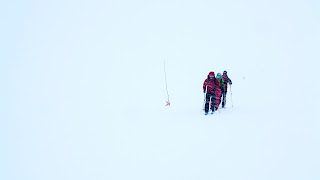
The final day, and allegedly one of the toughest to complete my 153km traverse. Compounded by the storm that has blown in overnight, I am filled with trepidation as I seal my clothing in preparation for the journey ahead…

I leave Le Manon for the mountain village of Bellecombe or 'beautiful bowl', which may be a beautiful bowl but is currently filled with misty soup, the occasional farmhouse-crouton and pine-tree-lardons. This open pasture winds its way alongside the limestone crest of the Haute Jura chain which occasionally pokes through the sleet filled clouds. After a steady climb I reach the high point just under the Cret au Merle (1448m), I know now that the end of the journey nears.

To complete this fantastic journey, I make a gradual descent through the forest to the trail end, near but not quite, at Giron. A knee-aching two-kilometre hike to the village was draining. My heart sank further when I am informed that there are no taxis to take me to the train station, a further 23km away. As I contemplate my next move over a sandwich and a cold fruity local beer, a random act of kindness is bestowed upon me. A lady called Florence overheard my troubles and, unbeknownst to me, asks the family at the next table, who were just leaving, if they will take me to the train station. They kindly agree. Within moments I have swallowed a sandwich, necked a cold beer, paid, said thank you to everyone in the room and am sat in the back of a family wagon, wedged between two sixteen year olds as we zig-zag down the hill towards Bellegarde-sur-Valserine. The family are truly delightful and it is a shame that the journey only lasts thirty-minutes.

Safely on the train, I take the time to reflect on my journey. In this quiet corner of France, amidst a weather beaten Gallic culture cut off for centuries from both France and Switzerland, it is not unusual to ski all day without seeing anyone else. This is a unique trip and a true journey on skis, where the enigmatic landscapes will captivate and reward even the most seasoned of traveller. The charm of places like the Jura lies in what they are definitively not: resorts designed to push as many people through the slopes as possible. And what is most striking about the Jura is the sense of how its small and charming ski resorts feel such a part of the local community and the landscape. For those reasons, I will be back.

Thursday, 28 February 2019

Grande Traversée du Jura: Day 5

Leaving Les Rousses via a complex network of pistes towards Premanon, the home to the French National Nordic Ski School and where several Olympic champions have come from. En-route I am passed in quick order by two members of the French national team on skating skis and by various high-speed pensioners, but, on the whole, the trail was spookily quiet. I cross more meadows and weave between roads to enter the Forêt du Massacre.

The forest houses some of the oldest fir trees in France and is named after an ancient battle in the area. A steady well-graded climb brings me to the high point of the whole journey, the delightful Chalet La Frasse (1400m) in the heart of the forest which I ski past before realising that they sold cake and beer… Too late! I was already enjoying some of the best skiing on the entire route on my rolling descent towards the delightful village of Lajoux. From there it was only a short stretch until I reach my overnight in the rustic hamlet of Le Manon.

Distance: 25km

Wednesday, 27 February 2019

Grande Traversée du Jura: Day 4

A few steps from my accommodation, I take to the trails once more and initially ski towards Bellefontaine before leaving the crowds behind and starting to climb into the Forêt Risoux - home to the famous wood needed to make the stradavarius violins.

Higher up, the terrain flattened out at last before the descent towards the village of Les Rousses. If there is an advantage to getting tired on cross-country skis, it is that you forget to think too hard about your balance and relax into the downhill. It is at these time that I realise why this region is known colloquially as ‘le pays qui respire' (the country with breathing space).

I wind my way along the well pressed trails to the outskirts of Les Rousses where the last of the snow has clung to the trail despite the strength of the baking February sun. Skis off my feet and on my shoulder, I wander into town to find a hotel for the night…

Distance: 21km

Tuesday, 26 February 2019

Grande Traversée du Jura: Day 3

Once again I journey into fabulous pine woods and through soon-to-be summer meadows. Reaching an open area of sparse trees beside the track, I set off across a large clearing of soft hummocks. The only people I saw was a small party on snow shoes until I got closer to the nordic ski centre at Pre Poncet. For the next three days I follow the race course of the world famous Transjurassienne. This will go someway to explain the many lycra-clad racing teams whizzing pasts me at high speeds.

I leave the racing track behind and venture once more into the forest. Snaking through the tightly forested slopes offer more challenging descents and I eventually pop out in the wide glaciated valley of the Combe des Cives. The terrain angle eases and I trudge the rest of the way to Chappelle des Bois for an early finish to consume my daily diet of local hams and Morteau sausage, honey beer and the extraordinary liqueur de sapin, an aperitif produced in nearby Pontarlier whose distinctive flavour comes from pine-shoot tips.

Distance: 19.5km

Monday, 25 February 2019

Grande Traversée du Jura: Day 2

The short steep climb from Longeville-Mont-d’Or takes me back off the beaten track into the ‘Doubs’ region, where I ski under the flanks of the highest summit in the region, Mont d’Or (1463m). I ascend through pine forest on good trails and enjoy skiing gently downhill to Mouthe. My descent enjoyable descent is at one point rudely interrupted as I learn a hard lesson. Where the sun has warmed up parts of the slope which makes the snow became sticky and throws me violently to the ground. Lesson learned, I will watch out for this in future...

As I enter the final forested slope before arriving in Mouthe, before me lay a steep icy chute to reach the main traversing track. With my heart in my mouth, I begin the descent, I quickly pick up speed and no matter how hard I brake, I continue to pick up speed! Add to this the fact that every time I crossed a line of sun on the snow, my body tenses as I prepare for the possibility of being slammed to the ground again. All of this make this short section easily the most terrifying ten minutes I have spent on skis.

With legs like jelly, I finally reach Mouthe and La Source du Doubs. There is a sting in the tail today as a final 2km climb takes me to my accommodation at the family run 'gîte' Chez Liadet for the night. It was hardworking to ski uphill, but well worth it.

Distance: 27km

Sunday, 24 February 2019

Grande Traversée du Jura: Day 1

As I am balanced precariously in a downward dog stance in the middle of an icy country road, poles in hand and skis on feet, I wonder why I did not stick with Plan A. I stare backwards between my legs and notice the rapidly approaching small red Swiss car and curse myself for changing my mind. Plan A was obviously the right choice. That is why it was Plan A!

Sometimes you choose to visit a ski resort for thrillingly shallow reasons: because bits of it are steep or deep or long; because of where it is; because of its reputation. At other times, the attraction is more subtle. The main factor driving my curiosity for the Jura Mountains: a growing affinity with small, community resorts – the kind of places where locals go to ski, that feel part of the culture and not somehow transplanted.

On paper, the Jura Mountains are France's best kept secret, and one of the least explored pockets of the Alps. Straddling the Franco-Swiss border, the Jura Mountains extend for a 250km arc from the Rhone to the Rhine. The ski route, which was first completed in 1978 (the year I was born), crosses the Haut-Jura regional park and follows much of the route of the world famous Transjurassiene ski race. Unlike the jagged peaks of the Alps, the landscape is more Nordic and rolling.

My plan was simple. I would ski a bit and eat a lot. My Grande Traversée du Jura (GTJ) starts in the Swiss town of St. Croix and ends 153 kilometers later at Giron, France.

Upon arrival in St. Croix, I carelessly and recklessly throw away my original plan (short taxi transfer to the trail head at Les Fourgs) in favour of the more adventurous option of following vague instructions from the Hotel owner to ski across Swiss snow-covered meadows to join the GTJ on the French border.

A short hike through town to the Col des Etroits and armed only with a tourist map, I am ready to depart on my cross-country skiing tour. After a shortly while the track splits, whereas the map shows just one route. I choose the left track simply because it does not cross a road (and there is no road marked on my map). After a little while further, the route begins to descend. The groomed piste then disappears and becomes a vague route on hard compacted snow. I am now picking up a bit too much speed on this descent. As I ski over and around all the bumps, a narrow road appears before me. I need to make a short, sharp turn to brake, but these are not the skis for that job, so I head for a part of the road that has a thin layer of snow. As I land from the small drop-off between the field and road, I realise that the road is covered in ice, not snow. I struggle to land and end up folded over looking between my legs at an oncoming red Swiss car. I try to scramble out of the way, but I have no traction at all. I resign myself to the inevitable skidding of tires and painful impact, but, to my surprise and relief, she simply squeezed past me. Is it wrong of me to question why she did not stop to see if I was OK?

On the other side of the road, I continue to follow the vague trial until it truly disappears. I take off my skis to hike up a narrow trial up through pine trees to reach La Gittaz Dessous. Here, with a weird mixture of happiness and anger, I find the correct trail and make up for lost time. I ski along the perfectly groomed piste, down through pine trees and across the gentle terrain to the border.

Shortly after crossing the border, I picked up the signs for GTJ to Les Hôpitaux Vieux. With navigation issues a thing of the past, I follow the well marked ski trail over a handy ski bridge to the snow-starved village of Les Hôpitaux Neufs. The GTJ ski trail continues gently over undulating terrain to a small ski town of Metabief.

Alternating through forests and clearings, used in summer as pastures for cattle, I join a network of trails where I begin to climb to the plateau of the 'Mont d'Or’, before dropping down to Longeville-Mont-d’Or for a well earned rest.

Distance: 32.5km

Thursday, 20 April 2017

Day 5 - Kebnekaise to Nikkaluokta

After breakfast at Kebnekaise, we begin the gentle descent to the trailhead at Nikkaluokta. The route mostly across the frozen surface of Ladtjo Lake is hampered by strong icy side winds and dodging between oncoming snowmobiles.

In Nikkaluokta, we wait for the bus in the comfort of the small café. The bus soon arrives and our next stop is clean clothes in Kiruna!

Ski Touring on Kungsleden, the King's Trail, from Abisko to Kebnekaise was a unique opportunity to immerse ourselves in the dramatic scenery of this remote region in the full glory of a Swedish winter.

Distance: 18.6 km

Wednesday, 19 April 2017

Day 4 - Sälka to Kebnekaise

At the start of the longest day, the wind speed has died down and it is relatively warm. We follow the Tjäktjavagge Valley, generally downhill and across easy terrain. We revel in being totally surrounded by mountains. We reach the huts at Singi after just 13 km of skiing, which are by a small lake in an open bowl surrounded by low hills. We stop here for a lunch break and I keep a promise by becoming an Arctic Postman :)

We climb away from Singi and leave behind the King's Trail, heading over a pass between the guardians of the wilderness - Lidducohkka and Singicohkka. As we head west through the Ladtjo Valley to the Kebnekaise Mountain Station, we sneak our first views of Kebnekaise (2117m) Sweden’s highest peak. In the shadows of Kebnekaise, the icy valley floor is difficult to traverse and further west the snow begins to disappear as the tracks are becoming more numerous.

Our last night in the mountains is spent at Kebnekaise Mountain Station, which offers sauna, showers and a well-earned restaurant meal as we ready ourselves for the final day's ski touring towards Nikkaluokta.

Distance: 26.0 km

Tuesday, 18 April 2017

Day 3 - Alesjaure to Sälka

An early start in bitterly cold temperatures is necessary today to complete what is likely to be the toughest day of the trip. After an initial descent from the rocky outcrop down an icy wall of death, the first part of today's route follows the wide open Ales Valley and then begins a gradual ascent on easy-angled slopes which, given the icy headwind, are nevertheless quite tough to ski up. That said, the huskies make it look easy as they pass us ;-)

Snow begins to fall and the gradient steepens as we leave the Ales Valley to begin the steady climb up to the Tjäktja Pass. A snow storm closes in as we reach the Tjäktja Hut, the highest on the King's Trail, so we seek shelter in the hut and have a spot of lunch.

After lunch, the storm has not passed, so we head into out into the whiteness to find the highest point on the King’s Trail. At a height of 1240m, we cross over the Tjäktja Pass. Sadly, due to the white out conditions, we miss the magnificent views from the shelter at the col over the Tjäktavagge Valley.

Beyond the pass, we are, however, treated to easy skiing down to the cabins at Sälka. The snow storm has made things more pleasant by providing fresh, and more importantly, soft snow for the descent.

The Sälka Hut is at a crossroads of several ski tour trails and there is an interesting mix of people in residence. The hut also has a shop with beer and a sauna. The only downside is that there is a five minute walk in gale force winds to go for a wee!

Distance: 25.2 km

Monday, 17 April 2017

Day 2 - Abiskojaure to Alesjaure

My eyes open to the sound of huskies howling outside the window of the cabin. I tentatively stick my arm out of my sleeping bag to test the temperature in the cabin. Pleasantly surprised, I begin my morning routine.

Despite today being a longer day's touring, involving some ascent, we start late to maximise the amount of time my repaired boot has to set. We start out along the valley, passing peaks rather than heading between them. As we follow the Kama River westwards, we realise that we are heading too far from the low col that we need to ascend.

Rather than the soul destroying act of retracing the route, we continue westwards until we reach a small group of houses and then put on our skins, turn to the south-east to cross a slightly higher col to enter the Alis Valley, which is dominated by shapely snow-peaks.

There is now a feeling of entering the high mountains as we continue through the Alis Valley. Travelling in a hilly landscape in between the peaks on a mountain plateau. Heading south, it is pretty level all the way to our overnight stop at the Alesjaure Mountain Hut. We take the option to cut directly across Ales Lake rather than stay on the marked trail at its edge in the hope of reaching the hut before sundown.

As the sun dipped behind the peaks that line the edge of Ales Lake, the temperature dropped dramatically. We could see a cluster of huts perched on a rocky outcrop at Alesjaure and so we decide to foolishly race the final few hundred meters to the hut rather than throw on our extra layers. It is surprising how quickly the cold seeps into my hands. The short steep climb to the hut fails to bring my hands back to life, but the warmth of finally entering the hut makes the blood flow once again to my hands and with it brings the pain of the hot aches.

The hut offers simple but comfortable accommodation and an excellent sauna in a separate hut. En route to the sauna, I take a quick snow bath and then start my evening routine.

Distance: 24.0 km

Sunday, 16 April 2017

Day 1 - Abisko to Abiskojaure

The King's Trail (known as "Kungsleden" in Swedish) is a long-distance path in the far north of Swedish Lapland, deep inside the Arctic Circle. Ski Touring on the King's Trail is one of the World's "classic" ski touring routes - challenging, spectacular and dramatic whilst not being too extreme.

The Abisko-Kebnekaise Trail is probably the most famous section of the King's Trail, running from Abisko Mountain Station on the shores of Lake Torneträsk south to the base of Mount Kebnekaise, Sweden's highest mountain at 2105 metres.

Our tour starts early fuelling up on the local delicacies of pickled fish, beetroot, boiled eggs,... I pity the people that shall be sharing our cabin this evening! With our flasks as full as our bellies, we head back to our room for last minute tinkering and then meet on the car park to wrestle ourselves into our skis for the first time. We then fling ourselves down the first steep icy slope of the day and the journey begins...

With the spring sun peaking above the horizon, the Arctic landscapes of northern Sweden, featuring majestic peaks and frozen waterfalls, are bathed in an ethereal light. All around is a snow-bound landscape of undulating countryside covered in birch and pine forest, with views across to the peaks of the Kebnekaise range. Lapporten, one the mountain world’s most famous silhouettes, watches over us as we pick our way between the silver birch trees, parallel to a partially snow-covered Kama River. The terrain is undulating and the route is very twisty. Eventually the route leaves the river and follows the borderline between woods and mountains. Just as we were leaving the shelter of the silver birch, disaster struck... My boot broke!

A quick decision is taken to return to the Abisko Mountain Station. One quick repair later, our group splits in two. One half head onward to the cabins on the south side of Lake Abiskojaure. The other half retrace the four and a half kilometres in search of a replacement or a repair.

The return journey to Abisko Mountain Station to yields no replacement boot and a limited number of repair options. I purchase the most promising option: a tube of glue and some more tape. We throw our lunch down our necks and head back out to the car park to the familiar launching spot for the trail.

The second attempt of the route takes us further into Abisko National Park and eventually to the frozen waters of Lake Abiskojaure. On the far side, we can just make out the smoke from the wood-burning stoves that our keeping the other half of the group warm inside the mountain cabin.

We power across the lake in no time and check into our cabin. We enjoy a warm meal that has been lovingly prepared by the other half of the group and reflect on the day's adventures. In the warmth of the cabin, I properly repair my boot and drink some whiskey with some fellow travellers. I then have a traditional Swedish sauna before climbing into bed - a welcoming haven after a long day on the trail!

Take One
Distance: 8.7 km

Take Two
Distance: 13.9 km

Wednesday, 30 March 2016

Hello Sunshine!

During breakfast, in the 70s Bond-villian-lare of a hotel, I discover the reason for the difficulties I had at the end of yesterday. The track had not been marked as the hotel was not sure if it could be open for business during the winter months as the hotel was still housing refugees up until a few months ago... Kinda puts my grumblings into perspective :-/

I am in no rush to leave the magnificent views overlooking Lake Hornsjø, but once I do, the skies turns blue as the blank canvas of white awaits my tracks...

With the sun high in the sky, it is not long before I meet a fellow skier - despite taking the route less travelled. The old gent and his bouncy, happy, chocolate labrador had been snowed in their cabin for the last three days and were now taking advantage of the sunshine to escape.

The floodgates appear to have opened as I pass a tsunami of skiers heading for Hornsjø during the first hour. After this tho, the trail goes quiet until I join the prepared tracks at Reina. With the true wilderness now over, I launch down the løypa and along the narrow spit of land separating the grand lakes of Reinsvatnet and Mellsjøen.

With its pristine pistes, fantastic views and gently undulating terrain, it is clear to see why this place has become a World famous cross-country skiing area.

On the outskirts of Nordseter, I rejoin the Trolls Trail to make the final push to Sjusjøen. Nothing too strenuous for the final day, this wonderful trail provides stunning views down to Lake Mjøsa and beyond.

Shortly before the centre of Sjusjøen, the Trolls Trail seems to just disappear and so I join the Birkebeineren Løypa to begin the grand finale of the trip. I follow this 15km ribbon of white all the way down to the Olympic Ski Stadium in Lillehammer. An excellent downhill to finish off the trip. Whilst I may not enter the stadium in the same style or panache as an Olympic athlete; I am just as grateful for making it here.

Tuesday, 29 March 2016

Sting in the Tale

I find it amazing that the best of days can so easily turn into the worst of days in one brief moment.

6am: It is an early morning start in the cabin as I have a long journey ahead of me. Outside the cabin I find roughly 10cm of fresh snow. With my skis on, I set off to lay the first (and possibly only) tracks of the day.

I head steadily south through the now familiar birch woodlands, past hibernating hamlets and frozen farmsteads; all of these abandoned for the winter months. Whilst the weather makes the journey testing, following the Trolls Trail is a sheer delight and it is with a heavy heart that at Langmyråsen, I leave the Trolls Trail to head to my accommodation in Hornjø. It is here that the problems begin...

Crossing the open mountainside to Lieden is tough as the sticky snow steals my glide. These two kilometres are hard work and easily the toughest of the trip. Things improve after Lieden, but then the trail just disappears. I am not able to find where I am on the featureless slope and in near whiteout conditions, so I simply descend to the road and follow that to Hornsjø. It is a difficult ending to a long and ultimately enjoyable day.

My overnight stay in Hornsjø Høyfjellshotell. Originally built in the 1870s, this place has been everything from a mountain farm to posting inn and from boarding house to hotel. For a period in the 1970s, Hornsjø Høyfjellshotell was the biggest in the country. Tonight, still with a 1970s feel to the place, I can enjoy the calm atmosphere and get myself ready for another adventures day.

Monday, 28 March 2016

Breaking Trail

The cold wind slaps me in the face like an old girlfriend this morning as I first venture outside my snug cabin. Breakfast is served a short walk away in the local cafe. I feel a little out of place, filling my face for the day ahead whilst old dears daintily digest each morsel. That said, it does not stop me :) With my boots filled, it is time to cross the road and continue the journey south.

The icy prepared løypa soon lead back to the freshly covered Trolls Trail. I am the first person of the day to lay tracks across the virgin snow. At some points I glide effortlessly and other times it is like wading through treacle as the sticky snow slows my progress. Even the few tumbles caused by the transition between these two states cannot spoil my enjoyment of this great route through the open birch forest.

With just 4km to the cosy little DNT hut at Vetåbua, the winds pick up and the sleet begins to fall. It is time for me to get indoors.

I ski along, with my head down, hoping that the bad weather of the past few days would work to my advantage for tonight. Lady luck shines on me as I am only sharing the hut with two lovely French engineers: Sébastien and Gwendoline.

The DNY huts are brilliant! They are stocked with food and logs for the fire. I love spending time in remote cabins like this. This hut is not staffed, so my time is spent collecting water, keeping the fire going and preparing dinner. All of these jobs are good fun and complete the mountain experience. So after my feast of smoked salmon on potato cakes for starters; Cashew Nasi for mains (thanks to Jan, Pia and Tom) and a huge slab of Melkesjokolade for dessert, I stoke the fire one last time and head to bed as I have a long day tomorrow.

Sunday, 27 March 2016

Following the Canes

I wake from my daylight-saving-time-deprived slumber to the sound of the windows being rattled by the howling wind. Not the most promising sign for the journey ahead. The worst is confirmed when I read the weather forecast... Severe weather warnings for the mountains, I am not going into the mountains today tho, I am just popping into the next valley ;-)

After what has become a morning routine, I retrace the last part of the route from yesterday to rejoin the Trolls Trail. On this cloud covered morning, the scenery is monochromatic. It is as if the strong winds have blown away all the colour.

I find the Trolls Trail without any hassle and continue to travel through the open high mountain terrain. The cold wind stings what little skin I have exposed to the elements and the visibility is poor. I struggle to navigate in the near whiteout conditions, but thankfully there are canes to guide the way.

I am granted a short break from the elements as I ski through a serene birch wood. It is almost long enough to forget how harsh the conditions are, but I am reminded all too soon as I begin the exposed pull up towards the plateau above Oksendalen.

On top of the plateau, the canes that have been my lifeline for today disappear without rhyme or reason. Out come the compass and map once more to see if my skills are up to the job.

Pleasingly, and somewhat fortunately, they are!! After approximately 2km in near whiteout conditions, I happen upon a signpost that confirms I am on the correct path. Moments later the canes reappear as I work my way over the final ridge line and down into the next valley.

As I descend out of the mist, I enter a winter wonderland of untracked fresh snow. I weave my way through the pine forest to spend a night at the Friisvegen Turistsenter. This is the strangest place that I have stayed at so far, but good Norwegian cooking is on offer, so I am a happy bunny :)

Saturday, 26 March 2016

Testing Times

There is a cold bite to the air as I lock up the hotel and hide the key. With my mind preoccupied with the challenge of most of today being off-track, I took a tumble skiing down the nursery slope as I set off to rejoin the løypa... How embarrassing!?

I leave the beautifully groomed løypa at Nestra and begin the climb onto the plateau. I wind my way, on a narrow icy track, through the trees. Popping out above the tree line, I stop to take in the stunning views into Frydalen. Shortly later I reach the sheet of ice that is covering the plateau.

The going here is tough as every two or three strides, I lose grip and slide backwards. The icy crosswind is also not helping matters and occasionally causes me to lose balance. There is a real wild feeling to the route today as I work my way across the mountainside past the DNT hut at Eldabu. The route then alters course and headlong into the icy winds.

For a brief moment, the wind dies down and the sun begins to shine. I take advantage of the respite to pause and take in this beautiful place. In the distance, I see two kite skiers dancing across the plateau. The winds begin to pick up and so my head drops to battle onwards and upwards.

Eventually, I reach the tracks coming from Venabu and snake my way between the small hills to my overnight in the quaint fjellhotel.

The route today has really tested me, so I eat, prep for tomorrow and get an early night ZZzZzz...

Friday, 25 March 2016

A Good Friday

Henrik Ibsen described the landscape that now make up the Rondane National Park as a “palace piled upon palace”. To be honest, I will need to take his word for this, as the visibility this morning is poor. I put on my skis on right beside the fjellstue. As I am adjusting my bindings, the first fat snowflakes begin to fall. I stand up, ready to depart, when suddenly a piste-basher appears. There is now a perfectly smooth white carpet to follow into the mist.

After the initial climb out of Høvringen, the terrain gently undulates. Soon I reach the end of the prepared løypa and head into more mountainous terrain. Despite the poor visibility and the more isolated location, there are still quite a few people out on the fjells. I later learn that the Easter weekend is traditionally the time when families in Norway head into the mountains.

The Smuksjøseter Fjellstue appears from between two peaks as I continue to slip and slide my way along the valley floor. Moments later a noise catches my attention. At first, I thought was a helicopter, but then what looks like a converted 2CV ploughs past me towing roughly twenty skiers behind it. As I stand there, bewildered, a second vehicle with more skiers shoots past me.

Given the number of new arrivals, I ski past the lodge and continue to wind my way across the mountain plateau. When I reach the tiny Peer Gynt-hytta, I take a short break. Gradually more and more folk appear out of the mist until the place is overcrowded. When the blue sky finally puts in an appearance, I take this as my cue to leave and start the silky descent to Mysuseter. The blue skies finally overpower the thick grey clouds, I take a look back to se the rounded peaks, deep corries and steep cliffs of the Rondane National Park.

Skiing through the tiny settlement of Mysuseter is a sheer delight. The route follows a babbling brook that has recently been awaken from its frozen slumber. I dodge between Silver Birch on my way down to Fujusjoen. Here, I ski along the edge of the frozen lake trying to find a safe place to cross to Rondablikk.

I am exhausted by the time I arrive in Rondablikk and horrified to see that my accommodation is a building site! Norwegian hospitality being what it is, I should not have worried. The owner has delayed her holiday to greet my arrival (as their only guest of Winter 2016). I am given solo use of a cabin that sleeps more than twenty and has a fully stocked fridge!

Thursday, 24 March 2016

Norwegian Words

The doors shut and the train slowly pulls out of the station. Through the window, the sights I have spent the last few days exploring whizz by as if my memory is on fast forward. As Lillehammer fades into the distance, my attention turns to the starting point of the epic journey along the Trolls Trail.

The train ploughs northwards along the valley floor. There is evidence that the sun is beginning to breathe life back into the frozen landscape. Time passes by quickly as I chat to the friendly locals and I am soon leaving the train in Otta.

Set deep in the Gudbrandsdalen, Otta occupies a strategic position at the confluence of the Otta and Lågen Rivers. Being the gateway to the Rondane National Park, Otta is the quintessential feeder town for the Norwegian wilderness: there is not much here in town and what little there is has already closed for Easter.

With nobody to ask and no information about the local bus, I simply trust the Internet research that I had completed days earlier. I retire to the waiting room to sit out the three and a half hour stopover. I am not the most patient person, so it is fortunate that the waiting room provides some much needed entertainment…

I enter the room to find one guy lying across several seats trying his best to get some sleep. Moments after my arrival, a rotund Norwegian lady enters the room. She barks, presumably Norwegian, words at me and my reply is simple: “English?” She huffs loudly to clearly show her lack of approval, and then wanders over to the sleeping guy. She then proceeds to talk at him for the next three hours!

In between there are several cameo roles. The highlights are: a Belgian couple who read the summer bus timetable instead of the winter one, resulting in an eye-watering £230 taxi ride and an English girl and her Canadian friend who somehow ski off the wrong side of the mountain – it will now take them two days to get back to their car!

Suddenly, as if there was a signal that only Norwegians can hear, people start to appear and, within the space of ten minutes, the place is again empty and I am on a bus heading to Høvringen.

The bus snakes its way up the steep cliffs that hold the Rondane National Park in place. At 1000 metres above sea level, the steep cliffs give way to the snow covered upland plateau. The old mountain village of Høvringen is the western gateway to the Rondane National Park and has several mountain lodges. Høvringen Fjellstue is one of the oldest and will provide me with food and lodgings for the night.

Saturday, 30 March 2013

In the Saboteurs' Footsteps


Day Seven: Rjukan Fellstue to Vemork

After a leisurely breakfast, I retrace my tracks from yesterday back to the final section of the Saboteurs' route. For only the second time during my trip, I attach the skins to my skis to tackle the steep ascent up to the col. Sweating at -10ºC is a strange sensation, the voice in my head is screaming at me to take off a layer, although I know this is not wise. So I try to occupy my mind with imagining what this must have been like seventy years ago...

The descent towards Rjukan begins as a wide and gentle slope, but soon the trees are coming thick and fast... The camber of the slope changes as the col closes in. I am now descending a steep, narrow gorge filed with trees and huge boulders.

With approximately one kilometre to go the route is just too narrow and steep for me to ski with any type of control. I remove my skis and slither down the side of the valley on foot. Through the trees, I spot the Vemork Hydro Plant perched on top of a cliff on the far side on a seemingly impenetrable gorge. How the hell am I going to get there!?!

As I slide further down the valley wall, I discover a small plaque confirming that I am indeed on the Saboteurs' Route. From here, there is a grand view of the Vemork Hydro Plant. The world's largest power station of the time in 1911 still looks as impervious to an attack as I imagine it was seventy years ago.

Soon after I pop out of the trees and join a road. With my skis now strapped to my bag, I slowly walk along the road to Våer. There is one road in and out of the Vemork Hydro Plant, which spans over a deep chasm with steep icy walls. As I cross the rickety old bridge, I wonder how these brave, resilient men managed, on the evening of the 27th February 1943, to cross this huge expanse.

The answer to this question and many more lies in the many interesting exhibitions in the museum which now fills the building of the old Vemork Hydro Plant. Before entering I sit at the memorial to the Heroes of Telemark and take a moment to contemplate my journey...

Travel is a demanding feat on the Hardangervidda Plateau. Here, man is not the measure of things. Here we are visitiors, and it is only fitting that we should feel small in such surrounding.  So few people wander into the remote corners of the World, I wonder how many more will come to follow? Who else will put on a pair of skis and break trails in pursuit of those secrets told only by wild places?

Once inside the museum, I soak up the history and decide that here is the perfect point to end my story. Before I go, I will leave you with one of my favourite quotes by Benjamin Franklin:
“Either write something worth reading or do something worth writing.”
Hopefully with this trip I have done both :)

Trip by numbers...
Distance: 8.8km
Vertical: 833m

Friday, 29 March 2013

Creature Comforts


Day Six: Helberghytta to Rjukan Fjellstue

The morning of my final expedition day starts with a discussion around the breakfast table. Kurt knows of a route that will, first, be shorter than my intended route and secondly be similar in nature to that used by the saboteurs... Of course, I jump at the chance :)

With my bag packed, I head away from the warmth of the hut and the security of the advised route. As I weave my way between the densely packed peaks, I can see why the saboteurs would use a route like this. Nobody would be able to find me in this maze of granite giants. There is a wonderful fascination about being amongst these majestic peaks. There are periods of quietude when all sounds recede until true silence reigns. For some people perhaps, true silence may seem unnerving, but for me it is reassuring, calming and conducive to feeling of peace and well-being. Here, beauty meets harshness; splendour meets seclusion.

I celebrate rejoining the main route (and shaving approximately 8km off my route!) with a short break to consume my special pink energy bar :) Just as I am ready to set off two Danish girls on their outdoor leader training arrive. We exchange pleasantries:
"where have you been?"

"where are you going?"

"yes, they are heavy skis!!" :)
I actually no longer mind answering this question as it is nice that people show a genuine concern for another human being. Incidentally, the next time I see these adventurous ladies, one will be upside-down and the other will be in a tree!

The main route winds it's way to a col where the descent to Rjukan Fjellstue begins...

I descend through tightly packed trees. It is like trying to sprint through a tube station during rush hour! There is no point looking for why I fall, just when. That said, my most spectacular tumble occurs when a branches catches my left ski, stopping it dead. Meanwhile I continue to balance on one ski for the next 200m with as much control as Frank Spencer on his wild roller skating journey. I eventually have to decide hitting the ground and hitting a tree. The ground gets my vote :)

Shorty afterwards, and panting heavily, I pop out onto the løype tracks and begin to meet people who are not kitted out to survive in the wilderness. This must mean that creature comforts are just around the corner...

A short, sharp descent from the tracks leads me to the cosy Rjukan Fjellstue. This historic mountain lodge is crammed full of farming artefacts from its days as a farmhouse. Tucked in one small corner is an exhibit to the Heroes of Telemark, which includes skis, outfits, parachutes, photos, the propeller of the plane that crashed,... It is all fascinating stuff and gets me in the mood for the final leg of my journey.

Trip by numbers...
Distance: 11.8km
Vertical: 668m